Marmarosy. Climbing Pop Ivan
Mount Pop Ivan (1936 m) is the highest point of the Marmarosa massif, which many call the Hutsul Alps. Local rocks and steep cliffs really resemble those same Alps, and from the top of Marmaros you can see the neighboring Romanian Alps.
Mount Pop Ivan (1936 m) is the highest point of the Marmarosa massif, which many call the Hutsul Alps. Local rocks and steep cliffs really resemble those same Alps, and from the top of Marmaros you can see the neighboring Romanian Alps.
Important! To issue passes to the border zone, we submit the participants’ details a week before the start of the hike, after which it will be much more difficult to join the group.
To receive a pass, you will need to tell us: full name, exact date of birth, passport number, who issued it and when, telephone number and registration address.
Trek plan:
RouteRoute map
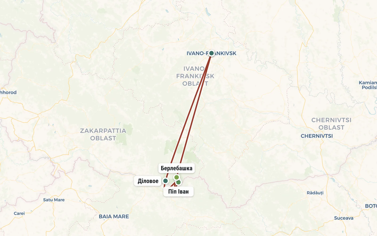 Open the map →
GPS-трек для маршруту ще не оцифровано — лінія орієнтовна (по ключових точках).
Day by dayItinerary
1 Day 1. Ivano-Frankivsk - village. Business - Lisich valley (14 km)
The group gathers at the Ivano-Frankivsk station around 9 am. We have a rather long journey ahead of us to Transcarpathia, to the village of Delovoe (altitude 350 m), known as the “geographical center of Europe”. There we check in at the border post, put on our backpacks and begin our climb into the mountains. We walk through the forest, along the White Potok River. At an altitude of about 910 m we cross the river for the last time and then our paths diverge. We climb the Marmaroshsky ridge and camp on the Lisich meadow (1470 m). As you can see, in a day we have to gain more than 1000 meters of altitude, which is quite a lot.
2 Day 2. Climbing the peak Pop Ivan Marmaroshsky (7 km)
The tents remain in the clearing, and we walk to the top almost lightly. We take raincoats, lunch snacks and water with us. The top of the Pop Ivan Marmaroshsky peak (1936 m) is just over 2 km in a straight line. But you can’t really run in the mountains, so the climb will take several hours. If the weather permits, we will have lunch not far from the top. We take pictures on the Romanian-Ukrainian border - it runs right along the mountain ridge. In the evening we go down to our camp on the Lisich meadow.
3 Day 3. Berlebashka, Yalinsky waterfall (15 km)
We will return to civilization along a different path. First, let's look at the Berlebashka peak (1734 m), and then continue our descent along the Scevora ridge (1466 m). Soon after its top and several valleys we will turn south to pass through the Yalinsky waterfall. Its height is about 25 m, but the flow is strong only after rain. We go down to the already familiar road near the White Stream and return to the village of Delovoe. We will arrive in Ivano-Frankivsk no earlier than 21:00 in the evening.
Note. The above describes an optimistic version of the route, for normal weather and a group with an average level of training. Based on weather conditions and the condition of tourists, the instructor can make changes to the route. Changes in the route do not affect the cost of the tour in any way.Booking
Порядок оплаты: Чтобы забронировать место в группе надо внести предоплату - 50 евро. В случае отказа от участия, предоплата не возвращается, но может быть передана другому участнику или сохранена на будущее (для оплаты других туров). Остаток стоимости тура оплачивается при встрече группы в Турции. В случае преждевременного схода с маршрута, деньги не возвращаются.
Real tripsTrip reports
No reports from this exact departure yet — showing reports from this destination by our groups.