Trolltunga trek
Troll's Tongue is a very popular place, and every day hundreds of people come here for great photos on the edge of the abyss. But by evening the usual tourists will run away, and we will be left alone with Norwegian nature. The further hike will take place through the deserted mountains surrounding the majestic Lake Ringedal. Be prepared for harsh weather, mud, sweat and snow.
Troll's Tongue is a very popular place, and every day hundreds of people come here for great photos on the edge of the abyss. But by evening the usual tourists will run away, and we will be left alone with Norwegian nature. The further hike will take place through the deserted mountains surrounding the majestic Lake Ringedal. Be prepared for harsh weather, mud, sweat and snow.
Program by day
RouteRoute map
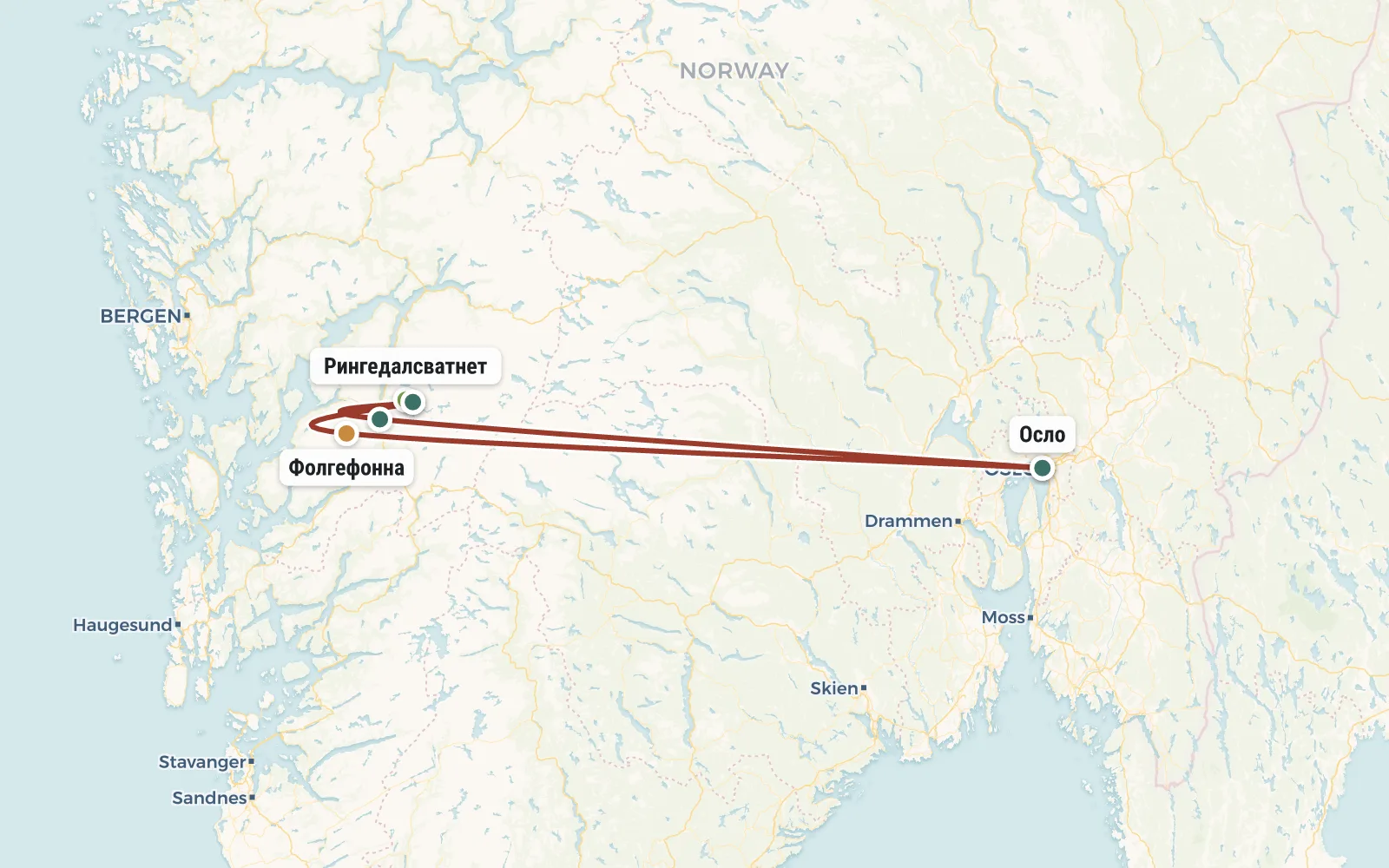 Open the map →
GPS-трек для маршруту ще не оцифровано — лінія орієнтовна (по ключових точках).
Day by dayItinerary
1 Day 1. Gathering in Oslo, bus to Odda
Formally, the participants of the trip get to Norway on their own, but in fact, in most cases you will not fly alone - there will definitely be company (other tourists or an instructor). Group meeting at Oslo Central Bus Station at 13:00. Don't be late, as our bus leaves for Odda at 13:30. If you arrive the day before, you can spend the night inexpensively at camping.
The trip to Odda will take about 7 hours and you will most likely enjoy it, because... The roads and buses in Norway are good (and not cheap - $65 one way) and the scenery is beautiful. Upon arrival, we set up tents in a city campsite (expensive but comfortable) or simply on the edge of the forest (free).
Bus - 7 hours, walk - 2 km.
2 Day 2. Rise to the Troll's Tongue
From Odda we take a bus to the town of Tyssedal, where we change to a minibus going to the mountains, to Lake Vetlavatnet. There, next to a powerful hydroelectric dam, the trail to the Troll Tongue begins.
The trail is not the easiest (ankle-deep mud, slippery) and very popular. At first we walk through a birch forest, and then an open slope begins with many streams, waterfalls and swamps. Behind you, a view of the large lake Ringedal and the dam begins to emerge, but it is far from certain that you will be in the mood to look at them. The trail goes up all the time and if you are not used to it it can be a bit difficult.
In a couple of hours we will reach the plateau and the going will become easier. True, the weather here is harsher - there are often strong winds, snowfalls (even in summer), and there are always snowdrifts in the ravines. Well, water - water (or dirt) oozes from everywhere. When we find a dry island, we’ll sit down and have lunch. We have to walk along the plateau for quite a long time (10 km) and we need to stock up on strength. The path winds among rocky hills and numerous reservoirs, from time to time approaching the edge of a rocky cliff from where you can see the majestic Lake Ringedal from a height that looks more like a sea, or rather a real fjord.
About 6 hours after the start we will most likely come to the Troll's Tongue. Most of the “vacationers” will have already begun to descend by this time and the queue for photography will be quite humane. Having checked in the Troll Language, we will go a little further forward and set up tents at an abandoned shelter.
Bus - 30 minutes, walk - 14 km, elevation gain - 950 m.
3 Day 3. Lake Ringedal - Preikestolen
Today we have a lot to go through, so we get up early. In addition, an early rise will allow us to run to the Troll's Tongue once again and perhaps even watch the sunrise there (during the “white nights” this can be problematic). After the photo shoot, we have breakfast and break up camp.
We will walk all day along a mountain plateau at an altitude of about 1200 meters. The elevation changes are insignificant at first glance, but it won’t be easy - snow, mud and weather will take care of it. We either go deep into the “continent” or return to the cliffs with stunning views of Lake Ringedal. One such place is called Preikestolen (pulpit). This is not “the same” Preikestolen, but the views here are no worse. Another unique attraction of the route is unexpected cyclopean structures (namely concrete dams) on completely deserted, ice-bound mountain lakes.
By evening we will try to reach the Mosdalbu hut (altitude 990 m), but it may well be that we will have to stop for the night in another place, because the path ahead is long. There’s nothing wrong with that - we have time to spare, we’ll be able to do everything.
18 km covered, ascent 700 m, descent 900 m.
4 Day 4. Moyfallsnuten (1466 m), descent to Odda
Today we have to overcome a significant difference in altitude. The first half of the day we will crawl up Mount Moyfallsnuten (500 meters of elevation gain), and in the afternoon we will begin a truly endless descent to Odda (900 meters of elevation gain). Take care of your knees - trekking poles are a must on this hike! If we manage to get through everything, we’ll spend the night at Odda’s campsite (hot shower!).
11 km covered, ascent 600 m, descent 1000 m.
5 Day 5. Folgefonna Glacier
In fact, this is a spare day in case of unexpected delays on the main route. But if we complete everything on time, then today we can arrange a bonus radial. There are two main options - go to the Folgefonna glacier (the third largest glacier in Norway) or rent a car and go to the waterfalls. We will decide on the spot based on the weather and the availability of gunpowder in the flasks.
If tomorrow we want to have a normal walk around Oslo, then today at midnight we need to leave Odda for Oslo. Travel time - 7 hours. Well, or you can spend the night at the campsite again and head to the capital tomorrow at 11 am (and spend the whole day on the bus).
6 Day 6. Walking around Oslo
The plan is standard - first we drop our luggage at a campsite or hostel, walk around the pedestrian center, go to the opera, look into the town hall (Nobel Peace Prize!), and then from the embankment we sail on a boat to the “museum island” of Bygdøy, where we will visit:
- ship Fram - the legendary wooden "icebreaker" on which Nansen and Amundsen explored the Arctic and Antarctic respectively
- Kon-Tiki raft on which Thor Heyerdahl proved the possibility of crossing Pacific Ocean on primitive watercraft
- Viking Ship Museum - real longships recovered from ancient ones burials
- open-air architecture museum - dark and majestic Norwegian ship churches and many other exhibits
If we have any strength left, then at the end we will take a look at the Vigeland sculpture park (extremely bright spectacle) and to the royal palace. We return to the campsite
7 Day 7. Flight home
The Norway tour is over, you can fly home
DetailsIncluded
Not included
- ✕Переліт до Норвегії - від € 100
- ✕Проживання в кемпінгах по маршруту (2-4 ночі, € 10 чол / ніч)
- ✕Автобусні переїзди (від € 130) і експрес в аеропорт (€ 20)
- ✕Прокат спорядження (взагалі не доступний в цьому турі)
- ✕Медична страховка - від € 20
- ✕Шенгенська віза (якщо у вас не біометричних паспорт)
- ✕Відвідування платних пам'яток (Oslo pass € 46)
Trip conditions
Accommodation. All overnight stays on this hike are planned in tents. B In some cases (especially severe weather) you can spend the night in mountain huts, but This is a very expensive pleasure. In Odda and Oslo we will stay in paid campsites. There is toilets and hot showers (€2 for 5 min). Everything You must bring the necessary equipment with you - rental in Norway equipment is too expensive.
Power. We bring most of the products from Ukraine and only The instructor purchases some items from Norway. The instructor's carrying capacity is not infinite, so during transportation supplies to Norway, the help of the trek participants will be needed. Before leaving On the route, the instructor distributes food and fuel (gas cylinders) among tourists. Each person receives about 5 kg of weight (men are more women less). The instructor will have boilers and burners with him.
Mobile communications and Internet. On a significant part of the route, mobile communications are normally received and mobile Internet is working - but you can count on them with confidence only in populated areas.
Weather. The Norwegian mountains have a very harsh climate. Snowfalls (as well as rains) occur with enviable regularity in the summer. Actually, it's very wet there - the ground is literally saturated with moisture. Average daytime temperature +10, at night there are frosts.
Difficulty level. In addition to difficult weather, be prepared for difficult terrain. You will have to walk a lot on stones of different formats and also through swamps - if you are not used to it, this will seem like a serious test. Before before going to Norway you should gain experience and at least a couple of times go to the Carpathians, preferably in the snow.
Booking
Порядок оплаты: Чтобы забронировать место в группе надо внести предоплату - 50 евро. В случае отказа от участия, предоплата не возвращается, но может быть передана другому участнику или сохранена на будущее (для оплаты других туров). Остаток стоимости тура оплачивается при встрече группы в Турции. В случае преждевременного схода с маршрута, деньги не возвращаются.
Real tripsTrip reports
No reports from this exact departure yet — showing reports from this destination by our groups.