Jotunheimen Express
A harsh route that allows you to climb Gallhöpiggen (the highest peak in Norway) and pass Bessegen (the most beautiful trek in Norway) in a short time. Jotunheimen National Park is located at altitudes from 1000 to 2400 meters, it is a real mountain tundra with reindeer, glaciers and summer snowfalls.
A harsh route that allows you to climb Gallhöpiggen in a short time (the highest peak in Norway) and walk Besseggen (the most beautiful trek Norway). Jotunheimen National Park is located at altitudes from 1000 to 2400 meters, this is a real mountain tundra with reindeer, glaciers and summer snowfalls.
Program by day
RouteRoute map
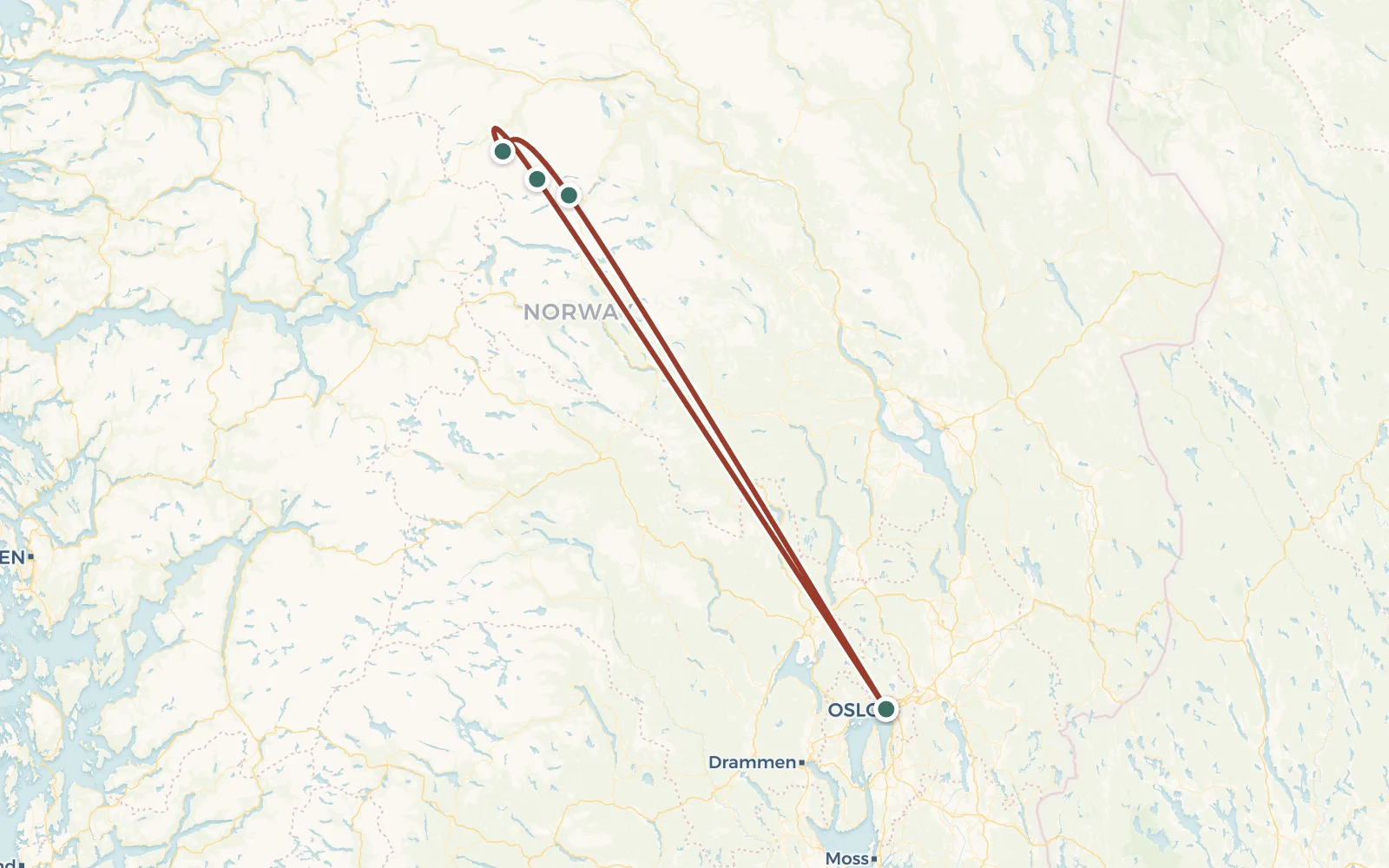 Open the map →
GPS-трек для маршруту ще не оцифровано — лінія орієнтовна (по ключових точках).
Day by dayItinerary
1 Day 1. Gathering in Oslo
Group gathering in the city camping Oslo. Arrival time does not matter. We set up tents and check equipment, distribute products
If you wish, you can walk into the center of Oslo, see the Opera, pedestrian center and embankment.
2 Day 2. Transfer to Jotunheimen, Spiterstulen shelter
Early rise. Our bus leaves from the central bus station at 8:40 to the mountains. We have to travel (with 2-3 transfers) for about 8 hours, which will be cost approximately €75. But the buses in Norway are comfortable, expensive good, and the views outside the window are simply magical. So the move must go through easy and interesting. Gradually the lush greenery of forests and pastures will be replaced the harsh grayness of the stone plateaus. Even at the height of summer, vast spaces here are covered with snow and at this moment many tourists begin to understand that Norway is still serious.
At approximately 16:00 we arrive at Jotunheimen National Park, or rather to the Spiterstulen shelter (altitude 1100 m). This is a huge tourist complex with rooms, a restaurant, bars and other amenities of civilization. We are We'll stay at a campsite (80 CZK per person) at this shelter, which located on the other side of the Visa River, away from the bustle of civilization. Here there is a shower, toilet and kitchen-dining room where you can hide from the weather and cook yourself dinner. We take places for tents and go to a small radial up the valley - just to stretch my legs and work up an appetite. Let's get acquainted with the Norwegian highland tundra - mosses, tiny birches and deep-water rivers.
Bus - 380 km, walk - 2 km.
3 Day 3. Climbing Gallhöpiggen - 2469 m
The tents remain at the campsite, and after breakfast we prepare to go out to the assault on the highest peak in Norway - Mount Gallhöpiggen. Climbing usually takes at least 10 hours - 5 hours to climb, 1 hour to the top, 3 an hour to descend. We have to gain more than 1300 meters of altitude, which are only 5 km horizontally. Those. the rise is enough steep and straight. At first the trail goes in a small zigzag along the rocks, but higher snowfields begin at the waterfall. It’s easier to walk along them head-on.
At an altitude of about 2000 m we reach a rocky ridge along which we will move all the way to the top. On the ridge we also mainly follow snowmen. To the left and right of us (and a hundred or two meters below) The huge Svellnosbreen and Styggebreen glaciers extend. It can be seen how hundreds of other climbers crawl along them on Galdhøpiggen - the mountain is not only tall, but also popular. On the way to the goal we go around two false peaks - Svellnose (2272 m) and Keilhaus topp (2355 m).
By 14:00 we should already be at the top. We take pictures and try to occupy seats in a tiny cafe hideaway. Here you can have lunch in the warmth (with your own products) and rest a little. We move down much faster and by 18:00 We're already heading back to the campsite. After a whole day in the snow, shoes will be needed drying, fortunately in Spiterstulen there is a drying room.
14 km covered, ascent 1350 m.
4 Day 4. Glitterheim
We leave the hospitable shelter and begin the climb to the opposite side our glacial valley Visdalen. After 400 meters of climb we we will find ourselves on a vast plateau along which we will move for a considerable part of the day, skirting another high peak - Glittertind 2465 m. in fact, there is a path that goes through this peak, but with heavy backpacks making a traverse will not be easy. Even the plateau we reached only seems simple at first. Firstly, it is really huge and we there is a long road ahead. Secondly, we will not have to go according to normal dirt path, and mostly jumping on rocks. And thirdly, periodically the Skauta river overflows onto the plateau and then it is necessary repeatedly wade (more precisely, jumping over stones) areas wide more than 20 meters.
We have lunch on snow-covered lakes in a gorge to the right of the Ryggeho peak 2140 m. This chain of lakes ends with an unnamed pass of 1650 m, beyond which The descent into the Veo River valley begins. The bottom of this valley is literally riddled with numerous streams. Water is seeping from everywhere and will eventually begin to ooze from your boots :) We set up camp on a dry mossy terrace walking 1 km to the Glitterheim shelter. There are no amenities here, but you have to pay no need.
18 km covered, ascent 700m, descent 300m.
5 Day 5. Lake Russvatnet
This morning there is a high chance of meeting reindeer on the banks of the river near our camp. We pass a large waterfall and the Glitterheim shelter, on shaky We cross the Veo River via a suspension bridge and begin the ascent to the pass of 1760 m, to the right of the top of Austre Hesltlaegerhoe 1950 m. Northern side of the pass often decorated with a dangerous snow cornice, so it is worth observing Be careful not to go close to the edge. We overcome another stone chaos and descend to the vast lake Russvatnet. We put up tents on it shore, height is about 1170 m. If you wish, you can swim, there is even small beach. But there is no wood for a fire here, so it’s better for swimming choose a sunny evening :)
12 km covered, ascent 400m, descent 650m.
6 Day 6. Lake Gjende
The easiest day of the hike. Tomorrow we have a very busy program, so it’s worth getting a good night’s sleep and rest today. After After breakfast we break up camp and walk along the shore of the lake for the first couple of hours Russvatnet. Then we storm the 1490 m pass that separates us from the valley, where reigns over the giant lake Gjende. We have lunch at the pass and then descend to the lake and camp near the Memurubu shelter. There's a lot here there is more greenery, there are trees and accompanying brushwood. Therefore theoretically we have some chance of an evening fire.
Tomorrow, to make things easier for ourselves, we will go to the Bessegen trail with small backpacks, and all other luggage (tents, sleeping bags, food, etc.) we will send you to your destination by boat. So tonight, bye there is time, you need to sort your things and pay for luggage at the shelter (€6 per piece of luggage).
10 km covered, ascent 500m, descent 700m.
7 Day 7. Бессеген
Бессеген считается одним из красивейших треккинговых маршрутов не только Норвегии, но и всей Европы. Он проходит по узкому скальному гребню разделяющему два разноуровневых водоёма - лазурное и огромное как море озеро Gjende и небольшое, тёмно-суровое озеро Bessvatnet. Первая половина пути мало отличается от предыдущих дней похода. Но потом на подходах к вершине Veslfjellet 1743 м начинается карабкание по довольно крутым камням, где понадобится не только переставлять ноги, но и держаться за скалы руками. Именно поэтому мы и избавляемся от лишнего груза. Перед выходом на маршрут, мы отнесём рюкзаки к причалу и сдадим их для отправки на катере на другой конец озера Ендэ. Чтобы успеть на автобус в Осло мы должны стартовать не позже 8 утра, так что подъём будет ранним.
Карабкаясь по Бессегену не забывайте оборачиваться - виды тут прекрасные, но второй раз вы вряд ли захотите это повторить :) С вершины Веслфьелет сравнительно быстро спускаемся к приюту Ендэбу, где нас уже давно дожидаются рюкзаки. Они приплыли сюда буквально за 20 минут, а мы ползли целый день. Кстати, если кого-то пугает перспектива пройти красивейший трек Скандинавских гор, он может тоже поплыть на катере с рюкзаками.
Поход по Ютунхеймену подошёл к концу. В 17:20 от приюта отправляется автобус в Осло (примерно €65). Он прибывает в столицу Норвегии около 22:00. Едем в уже знакомый кемпинг на холме Экеберг.
Пройдено 14 км, подъём 1050м, спуск 1050м.
8 Day 8. Tour of Oslo
In fact, today's excursion is a spare part in disguise during the day in case of bad weather or other unforeseen delays on the main route. Therefore, even if you are already familiar with the sights of Oslo You shouldn't buy tickets for today, because... there is a risk of not being able to return to Oslo on time. However, it's up to you to decide.
Well, we’ll go to the “island of museums” Bygdøy, where we will visit:
- ship Fram - the legendary wooden "icebreaker" on which Nansen and Amundsen explored the Arctic and Antarctic respectively
- Kon-Tiki raft on which Thor Heyerdahl proved the possibility of crossing Pacific Ocean on primitive watercraft
- Viking Ship Museum - real longships recovered from ancient ones burials
- open-air architecture museum - dark and majestic Norwegian ship churches and many other exhibits
And at the end we will take a look at the Vigeland sculpture park (extremely bright spectacle) and to the royal palace. Let's go back to the campsite!
18 km covered.
9 Day 9. Flight home
The tour of Norway is over, you can fly home or continue exploring with Scandinavia on a trip to the Troll's Tongue or on the Lofoten Islands. Or or fly from Norway to Iceland and explore another country real Vikings.
DetailsIncluded
Not included
- ✕Переліт до Норвегії - від € 100
- ✕Проживання в кемпінгах по маршруту (6 ночей по € 10 чол / ніч)
- ✕Автобусні переїзди (€ 75 + 65)
- ✕Катер (€ 6) іекспрес в аеропорт (€ 20)
- ✕Прокат спорядження (взагалі не доступний в цьому турі)
- ✕Медична страховка - від € 20
- ✕Шенгенська віза (якщо у вас не біометричних паспорт)
- ✕Відвідування платних пам'яток (Oslo pass € 46)
Trip conditions
Accommodation. All overnight stays on this hike are planned in tents. B In some cases (especially severe weather) the group spends the night inside shelters, but This happens rarely, because they are usually crowded and quite expensive. B half of the time we will be camping in paid campsites. There is toilets, and for an additional fee a hot shower (€2 for 5 minutes). Everything You must bring the necessary equipment with you - rental in Norway equipment is too expensive.
Power. We bring most of the products from Ukraine and only The instructor purchases some items from Norway. The instructor's carrying capacity is not infinite, so during transportation supplies to Norway, the help of the trek participants will be needed. Before leaving On the route, the instructor distributes food and fuel (gas cylinders) among tourists. Each person receives 5-6 kg of weight (men are more women less). The instructor will have boilers and burners with him.
Mobile communications and Internet. On a significant part of the route (except 4 and 5 days) mobile reception is normal and mobile Internet is working - roaming of Ukrainian operators or virtual operators like TravelSim.
Weather. The climate in the Jotunheimen mountains is very harsh. Snowfalls (as well as rains) occur with enviable regularity in the summer. Actually, it's very wet there - the ground is literally saturated with moisture. Average daytime temperature +10, at night there are frosts.
Difficulty level. In addition to difficult weather, be prepared for difficult terrain. You will have to walk a lot on stones of different formats and also through swamps - if you are not used to it, this will seem like a serious test. Before before going to Norway you should gain experience and at least a couple of times go to the Carpathians, preferably in the snow.
Booking
Порядок оплаты: Чтобы забронировать место в группе надо внести предоплату - 50 евро. В случае отказа от участия, предоплата не возвращается, но может быть передана другому участнику или сохранена на будущее (для оплаты других туров). Остаток стоимости тура оплачивается при встрече группы в Турции. В случае преждевременного схода с маршрута, деньги не возвращаются.
Real tripsTrip reports
No reports from this exact departure yet — showing reports from this destination by our groups.