High Tatras
Hiking with light backpacks in the High Tatars in Poland. All overnight stays are in shelters - no tents needed, we only carry food and sleeping bags. Lots of extreme radials - i.e. without backpacks at all, but with steep climbs, narrow ridges with chain-rails, dizzying cliffs, etc. The difficulty level is medium-high - more difficult than in the Carpathians, easier than in the Caucasus. For beginners (who have never been to the mountains before) the route is contraindicated. The weather is unpredictable - rain and wind are possible. To travel to Poland you must have a Schengen visa or biometric passport.
Hiking with light backpacks in the High Tatars in Poland. All overnight stays are in shelters - no tents needed, we only carry food and sleeping bags. Lots of extreme radials - i.e. without backpacks at all, but with steep climbs, narrow ridges with chain-rails, dizzying cliffs, etc. The difficulty level is medium-high - more difficult than in the Carpathians, easier than in the Caucasus. For beginners (who have never been to the mountains before) the route is contraindicated. The weather is unpredictable - rain and wind are possible. To travel to Poland you must have a Schengen visa or biometric passport.
Trek plan
RouteRoute map
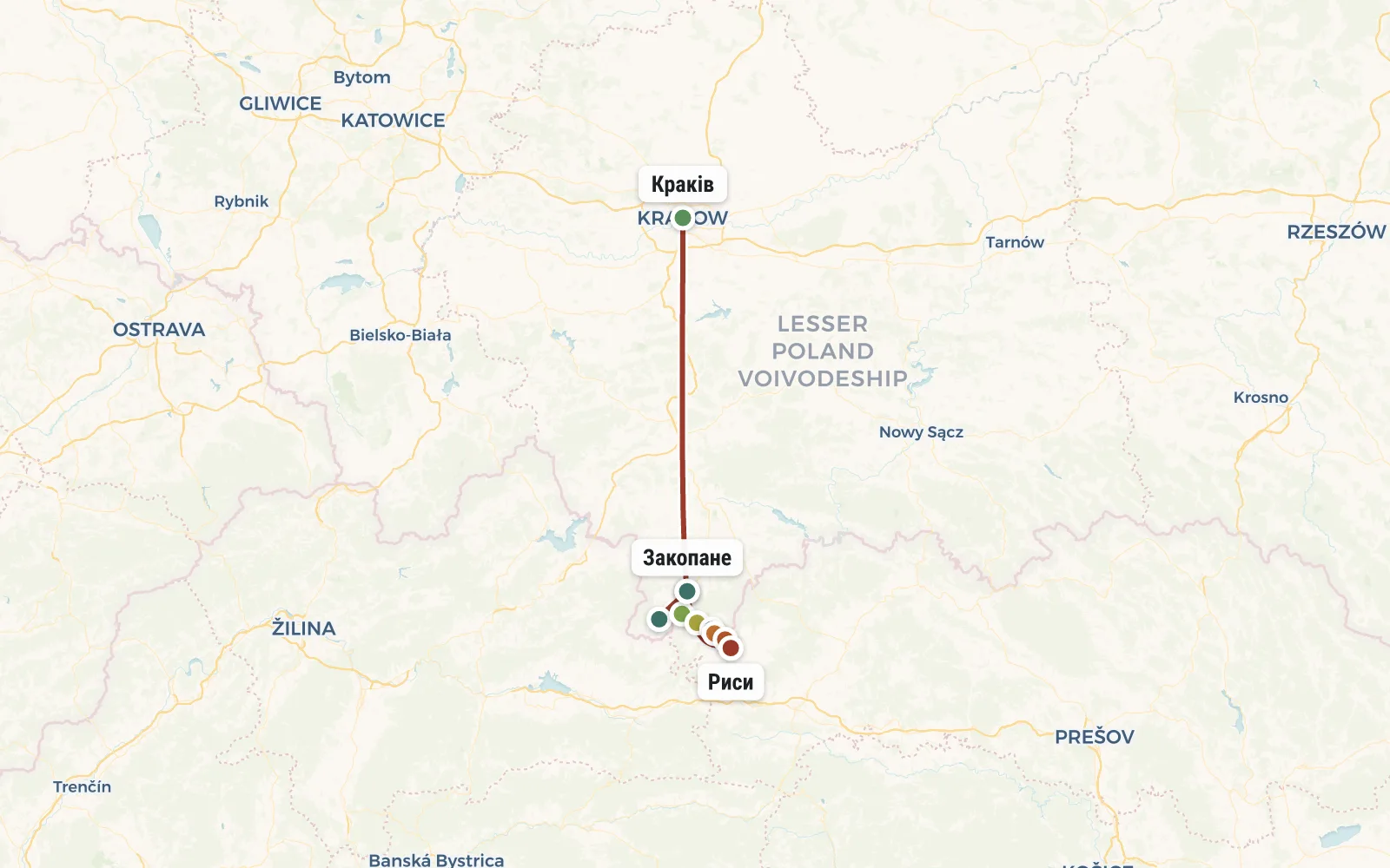 Open the map →
GPS-трек для маршруту ще не оцифровано — лінія орієнтовна (по ключових точках).
Day by dayItinerary
1 Day 1. Zakopane
Group gathering in Zakopane (Poland). This is a resort town at the very foot of the High Tatras. We will book a hostel here (or even an entire estate) in advance, where we will meet. The time of arrival does not matter - arrive either in the morning or at midnight. For information on how to get to Zakopane, read the section Transport.
2 Day 2. Koscieliska Valley, 3 caves, Wonwuz Canyon Krakow
Today we have our first radial. Things stay at the hostel, we take with us only a windbreaker (in caves +5), a flashlight (required), a lunch snack and money. But you won't need trekking poles today. And in general, you need to try to limit yourself to a minimum of things, because... The caves are very crowded. We take a minibus to the village of Kira (30 minutes), pay for the entrance to the Tatra National Park and go into the Koscieliska valley.
In the Koscieliska Valley we visit 3 caves - Mrozna (equipped, paid), Raptawicka and Mylna (free, flashlight required). The caves are quite cool (+5) so you need to take a windbreaker with you. We have lunch at the Ornak shelter (altitude 1108 m) where there is free boiling water (tea, noodles, etc.). After lunch, if you have any strength left, you can go to Lake Smrecinski (plus 1 hour) or immediately turn back to the bus.On the way back we look at the shady gorge of Wonwuz Krakow - a deep canyon with vertical walls and a special atmosphere of the “Lost World”. We return to Zakopane.
Travel time: 8 hours. Distance: 14 km. Elevation gain: 500 m.
3 Day 3. Radial route to Mount Giewont (1894 m) + Siklavica waterfall, Serna rock and Albertine monastery
Early rise, breakfast, set out on the route (things remain in Zakopane). We get to the entrance to the reserve on foot (5 zlotys), along the Bialego valley we climb to Czerwona Przelecz (Red Pass, 1301m). There is an excellent viewpoint nearby - the Chamois rock (1377m). Having visited it, we continue our way to Strazhiskaya Polyana, from which we will make a foray to the Siklavitsa waterfall. Then about 1 hour of climbing and we are at the pass to Grzybowca (1311 m). Then we go on a traverse, gradually going around Mount Giewont, and in the end, after a small extreme fragment with chains, we go to the peak of Giewont (1894 m) decorated with a huge cross.
We have lunch on the saddle near Giewont and begin our descent in an easterly direction (we climbed from the West). An hour and a half later we arrive at the shelter on Kondratova Polyana. We get boiling water and drink tea. Then we continue to drop altitude. On the way we pass the Albertine monastery. As a result, we find ourselves at a bus stop, 10 minutes drive and we are in Zakopane. Tomorrow we are leaving this town and moving to a remote shelter, so today we need to replenish food supplies and wash and do laundry.
Travel time: 10 hours. Distance: 16 km. Elevation gain: 1000 m.
4 Day 4. Mount Kasprowy Wierch (1987 m), Svinitsky pass, Svinitsa (2301 m), Black Lake, Murovanets shelter
We wake up early again so that at 7:30 we are already standing at the cable car station (with backpacks and all our belongings). The cable car for 50 zlotys will take us to Mount Kasprowy Wierch (1987 m). In winter, this is a ski Mecca, so at the top, in addition to the observation deck, there is a restaurant and souvenir shops. But that's not what we came here for. We set out on a route along the path along the Polish-Slovak border. She walks along the spectacular ridge of the mountain, sometimes climbing up, sometimes falling down. Having reached the Svinitsky pass (2051 m), we throw off our backpacks and go on a radial path to the top of Mount Svinnitsa (2301 m). There will be some chains and a stunning panorama of the upper reaches of the Five Staves valley. We return to our backpacks and have lunch.
We turn left and descend from the ridge into a valley with beautiful mountain lakes (Green, Krasnoe, Dlinnoe and others). Unfortunately, swimming here is prohibited, but you can take a break on the shore. We meander among the lakes and climb to the Karb pass (1853 m), from which there is an excellent view of both the already familiar lakes and the new one - the huge Black Lake. We go down past the Black Lake to the Murovanets shelter, where we will spend the next 2 nights. An overnight stay here costs about 40 zlotys. We will have our own food, but you can also order from a local kitchen (on average 25-30 zlotys per dinner).
Travel time: 6 hours. Distance: 7 km. Elevation gain: 400 m.
5 Day 5. Radialka on Orla Perts, Zavrat pass (2158 m), Koziy Verkh mountain (2291 m)
Today is the most difficult and most action-packed day of our hike in the Polish High Tatras. We are going to storm the Orla Perts trail (Way of the Eagle). She walks along a narrow rock ridge, in places equipped with steel chains and brackets for safety. Be sure to bring work gloves (for working with chains) and a reserve of courage. To complete the route normally, you need to make the most of the stable morning weather. At 7 am we should already be on the trail. We quickly run past yesterday's Black Lake, climb the ridge in the area of the Zavrat pass (2158 m) and enter the Eagle trail.
At the beginning of the season (June), the couloir along which we will go to the Zavrat pass is often clogged with snow. In this case, you will need crampons and an ice ax. You don’t have to take them with you, but rent them at the Murovanets shelter.
Behind the pass the Orla Perc trail begins and our speed of movement drops sharply. You can walk 1 kilometer here for an hour or two. Firstly, because of the complexity of the route, and secondly, because of frequent traffic jams, the place is iconic and very popular. We crawl, climb and cling for 5-6 hours until we reach Mount Koziy Verkh (2291 m). However, there will be a break for lunch. Behind Kozim Verkh, a quieter path begins, and then a descent to the already familiar Black Lake. Let’s stop shaking in our knees and go have dinner at the Murovanets shelter.
Alternative options: If you are not yet ready for the extreme trek of the Eagle Trail, then you can skip this part of the route and just stay at the shelter for the day or sunbathe by the lake. In case of bad weather, it is possible that the whole group will not go to Orla Perts, but instead we will go to another, simpler section of the same ridge - to the three-headed Mount Granata (2240 m).
Travel time: 10 hours. Distance: 10 km. Elevation gain: 800 m.
6 Day 6. Krzyzne Pass (2112 m), Valley of the Five Staves, Siklava Waterfall
We finally leave the Murovanets shelter and with our backpacks we set out on a new path towards the familiar ridge. We cross the Zadny Uplaz spur and find ourselves in the Panščica valley, completely overgrown with dwarf elfin trees. From the next Red Lake (1670 m) a long climb begins to the Krzyzne Pass (2112 m). From the pass we admire a gorgeous view of the huge waterfall and the valley of Pyati Stavov (Pyatiozerye), where we have to go down.
A couple of hours later, finding ourselves down at the Front Lake, we check into another shelter - this time much more modest (no hot shower) but located in an extremely picturesque place. We leave our things and go for an evening walk to the five lakes and Siklava waterfall.
Travel time: 6 hours. Distance: 8 km. Elevation gain: 700 m.
7 Day 7. Mount Szpiglasowy Wierch (2172m), Lake Morskie Oko, Zakopane
From the shelter we return to the Great Stav Polski (the largest of the lakes in this valley), go around it from the West and begin the climb to the Shpiglas Pass (2110m). This will take about 2 hours. From the pass we make a short radial hike to the top (2172m), and then descend to Morskie Oko Lake. The trail passes under Mount Mnich (2070 m). This is one of the most beautiful peaks in the Tatras - a real rock fang. In 2-3 hours we will reach Lake Morskoe Oko. We walk around the lake a little, stop by the cafe of the local shelter, and then begin the descent.
We stop for the night at the Roztoky Valley shelter, about an hour and a half walk from Lake Morskie Oko. This is a quiet and cozy place, in the forest, literally on the border with Slovakia. Early lights out.
Travel time: 8 hours. Distance: 20 km. Elevation gain: 500 m.
8 Day 8. Climbing Rysy Peak (2500 m)
Today we are going to climb the highest peak in Poland - Rysy Peak (height 2500 meters). To do this, we wake up at the crack of dawn, pack our things and put them in a storage room. We go for the climb with a minimal set: crampons (only in June), raincoat, windbreaker, trekking poles, gloves, lunch snack, bottle of water. We climb along the road to Lake Morskoe Oko and then (already along the path) past full-flowing waterfalls we go to Black Stav near Rysy. Behind the camp begins the trail to the top of Rysy Peak (2500 m) - the highest peak in Poland. The peak is located on the border with Slovakia and there is also something to see on that side. The ascent will take about 4 hours (with chains, staples and other gags), the descent will take about 3 hours. The route is a little easier and shorter than the Eagle Trail, so everyone can do it.
Halfway down the descent we will stop for lunch. Upon returning to the Roztoky shelter, we collect our luggage from the storage room, repack our backpacks and head down to Zakopane. You can walk (1 hour on asphalt in the middle of the forest) or ride a horse-drawn minibus (20 zlotys). At Polana Palenice we change to a bus (30 minutes) and arrive in the center of Zakopane around 18:00. The hike is completed, you can leave for Krakow, or stay one more night in Zakopane.
Travel time: 10 hours. Distance: 8 km. Elevation gain: 1500 m.
DetailsIncluded
Not included
- ✕Дорога до Закопане і назад - від € 75
- ✕Прокат альпіністського спорядження - від € 40
- ✕Медична страховка - від € 12
- ✕Відвідування їдалень і ресторанів (за бажанням)
- ✕Спуск від Морського Око на конях
Trip conditions
Since it is strictly forbidden to pitch tents in the Polish Tatras, we do not take tents. We will spend the night in apartments (in Zakopane) and in mountain shelters. The level of comfort in shelters can vary greatly. With equal probability, we can get a separate room with 4 beds (60 zlotys), a cramped bedroom for 20 people with multi-story bunks (40 zlotys), and a thin mattress on the kitchen floor (20 zlotys) or just a place on a flight of stairs (10 zlotys). The Tatras are a very popular place and during the “season” the shelters are constantly overcrowded. If possible, we will try to book beds in advance, but this does not help much - in the most popular shelters, places are purchased 8 months before the start of the season. Even mattresses on the floor may not be enough. This is why we take thin rugs and sleeping bags with us - at the same time, this will help save on bedding, which shelters offer for an additional fee.
Mountain shelters (skhroniski in Polish) have showers and toilets. Sometimes a shower means hot water, sometimes it doesn't. In the archives there are kitchen-dining rooms where you can inexpensively get boiling water, buy something edible (chocolates, etc.) or even order dinner. To save money, we prepare our own food - we bring sublimates with us. In addition, the instructor will have a gas burner and a pot. But if you want to diversify your menu and order food from the shelter kitchen, the instructor will not object - the main thing is that in the morning, while waiting for breakfast, you do not delay the group’s departure to the route. For lunch we take a traditional camping snack - bread, cheese, sausage, ketchup, cucumbers, chocolate plus spring water.
The group leader reserves the right to make changes to the route in depending on the weather, condition of the participants and other factors.
Booking
Порядок оплаты: Чтобы забронировать место в группе надо внести предоплату - 50 евро. В случае отказа от участия, предоплата не возвращается, но может быть передана другому участнику или сохранена на будущее (для оплаты других туров). Остаток стоимости тура оплачивается при встрече группы в Турции. В случае преждевременного схода с маршрута, деньги не возвращаются.
ReviewsTraveller reviews
Первое знакомство с польскими Татрами произвело на меня огромное впечатление. Всего в нескольких часах от границы Украины оказывается "растут" такие большие и суровые горы. Они похожи одновременно и на Альпы, и на Кавказ и на мою любимую Норвегию.
Усталость и страхи давно позабылись, остались лишь приятные воспоминания о новой стране.
То... Звісно друзі ідіть в Татри! Там дійсно дуже круто! Ці безкраї простори, ця велич, цей спокій і тиша, якими дихають гори...
З Кирилом ми пішли вперше. Зразу скажу, кращого інструктора, який попереджає про всі складнощі, який РЕАЛЬНО описує складність маршруту і дня, який ПРАВДИВО говорить про кілометраж, набір висоти і т.д. - НЕ ЗНАЙТИ.
Эти горы превзошли мои ожидания - не смотря на "цивилизованность" и многолюдность Татры подарили нам две тонны адреналина и массу вполне "взрослых" горных пейзажей. Это место, куда есть за чем возвращаться.
У Смречинского става мы были и вовсе одни. Душевнейшее место. Мы там просто залипли - фоткали туман, болтали о чём-то, грелись на солнышке.